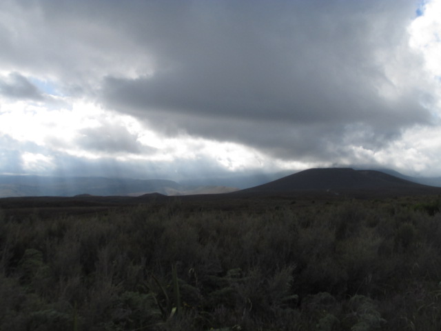
As we set off across the plains of the Taupo Volcanic Zone this morning, we bore witness to the incredible natural landscapes unique to New Zealand. Lit under ethereal rays of sunlight shining through the morning overcast, we got our first good glimpse of the three volcanoes at Tongariro National Park: Ruapehu (pronounced Roo-ah-pay-hoo), Ngauruhoe (Nowr-a-ho-ee), and of course, Tongariro itself.
Our planned 20-km hike across the Tongariro Alpine Crossing had to be cut short because of increased volcanic activity at one of the vents of Tongariro. Driving in, we were able to see a large amount of steam pouring out of this vent - quite a dramatic sight!
We stopped at the nearest village to the trails of Tongariro itself; the village of Whakapapa ("pronounced FA-KA-PA-PA", as Grant helpfully explained). The one issue we had was making lunch. As we had to take a shuttle bus to the beginning of the trail, we had roughly 15 minutes to make 24 sandwiches. So we divided and conquered and literally ran into the shuttle bus with seconds to spare. That was probably the least of our challenges for the day!
When we arrived at the entrance to the trail, we spend the first few moments being astonished at the size of the volcano and its associated lava flow. Once we tore our eyes away from the sight, the fourth year students provided the entire group with a short explanation of the tectonics responsible for the volcanoes, and of its geologic past. Once the discussion had ended, we set out.
 |
| Shilika, Roma, and Daniel explain our geographic context and the associated plate tectonics leading to the marvels behind us |
 |
| Group shot! Before the exhausting journey. |
Wow. That is really the only way to describe the next five hours of our lives. The Alpine Crossing trail itself was largely uphill and began at 1100 meters. We saw amazing geologic evidence of past lava flows on Ngauruhoe, and walked amongst the silent giants of the crossing for several kilometers.
 |
| Columnar basalt in an old magma chamber next to Ngauruhoe |
 |
| Hiking in the valley leading to the first steep climb |
 |
| Ngauruhoe, or: Mount Doom! |
Once we cleared the most difficult part of the trail, the group split into two. One group climbed the rest of the treacherous slope to the rim of Ngauruhoe, while the other half observed the Emerald Lakes and Red Crater on Tongariro.
The group climbing Ngauruhoe had a very difficult task ahead of them for the final 400 meters or so - there was no clearly marked path and much of available surface was coated in very loose tephra and sediment. Each step let off a small avalanche of rocks, so we had to be careful to space ourselves so as to not injure each other. After an excruciating journey up above even the (lowest) clouds, we strained the final few meters to reach the crater rim, where an astonishing view of both the complex geologic nature of the stratovolcano and the majestic beauty of the rest of the North Island was at once visible to us.
 |
| A view into the volcano's crater: the layered structure of a stratovolcano is visible on the left |
.jpg) |
| "We look like a Russian exploration team" |
 |
| Looking out over Tongariro from Ngaurahoe: a floodplain is visible to the bottom left, and Blue Lake is in the centre |
 |
| Fumarole (steaming vent) in the hill behind Maddy! |
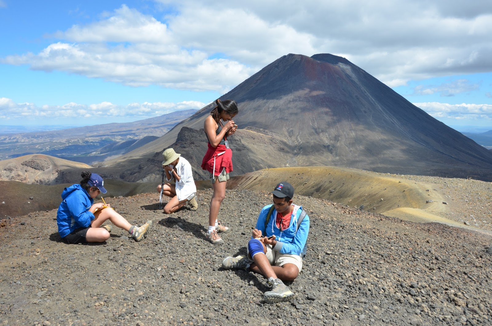
Meanwhile, the Emerald Lakes group got a good view of the old craters of Tongariro. Red Crater itself, at the highest point of the Alpine Crossing (~1800 m) is a currently inactive volcanic crater which was explored and sketched by the group. The bright green Emerald Lakes were a spectacular visualization of the high concentration of dissolved minerals unique in volcanic environments.
 |
| Red Crater |
|
 |
| Describing landscapes, analysing samples, and taking notes with Ngaurahoe in the background |
Overall, the day was exhausting. Once returning to the campsite, there was a short period of swimming before dinner, after which most people collapsed into their tents. It was truly a spectacular, once-in-a-lifetime experience for all students, and we are all extremely pleased with what we learned and accomplished.
Tomorrow we're leaving the lake (unfortunately!) and heading back to the Auckland area, where we will spend the next day observing the geology of the region. The day after that we're hopping on a plane to Christchurch!
Thanks for reading!


.jpg)


No comments:
Post a Comment