Tuesday, 19 February 2013

Day 3: The Road to Piha

After our exhausting trek yesterday, we allowed ourselves an extra hour or so of sleep this morning. Despite that, almost everyone was up by 7:00 AM, and we were packed and on the road again just after nine. We waved goodbye to Lake Taupo, and though we were leaving behind the beautiful scenery we were also heading towards a far better campsite.


A few kilometers away we stopped at a lookout to get a final glimpse and to hear more from the GLG465 students regarding the underlying geodynamics of the region. We got a primer in magma genesis and gravity anomalies, as well as information about identification of eruption deposits based on ash analysis (the subject of one of the students' thesis research).


Then we were off! On the road again, this time back towards Auckland in the northwest. It was a long drive there, with many swerving trails through treacherous roads (and more than some coaxing of the GPS). We passed some interesting limestone formations (including areas that Henderson himself claimed he'd never been through), and a herd of the iconic animals this country is known for - sheep!


Late in the afternoon we finally pulled over the top of the hill on Piha Road, and were greeted with the magnificent hidden beauty of Piha Beach. We descended down the hillside, and pulled to a stop down shore from the famous Lion Rock. Then it was time to whip out the bathing suits! It was our first taste of the ocean since arriving, and everyone was excited to feel the sand and surf.


Some of us went over to examine Lion Rock. There were huge, dark, igneous clasts embedded in a very fine matrix on the side facing us, which we interpreted as being laid down in a large, explosive, proximal volcanic eruption.


(Geologist for scale)
There was also a particularly nice chert nodule embedded in the rock!


As we climbed the set of stairs carved into the rock, we came upon a visible stratification on the opposite side. This could have been from a previous eruption at a more distal location, producing a finer bedding of ash with distinct layering.


Finally, we reached the top of the rock! Or at least, as far as one could go: the old path leading all the way to the top appeared to have crumbled at one section, shortening the path to just a lower section. Still, it was a great experience to be up there - we had an amazing view of the entire beach!


"We were here"
As the clouds moved in and a light drizzle descended upon our party, we decided to pack things in and head to our campsite in Auckland. Some more minor detours through hilly, winding roads and a few wrong turns later, we finally came upon the site - only a few kilometers from Auckland International Airport, perfect for us to get up bright and early (5 AM!!!) for our flight to Christchurch!

See you in the South Island!

Monday, 18 February 2013

Day 2: The Top of the Bottom of the World

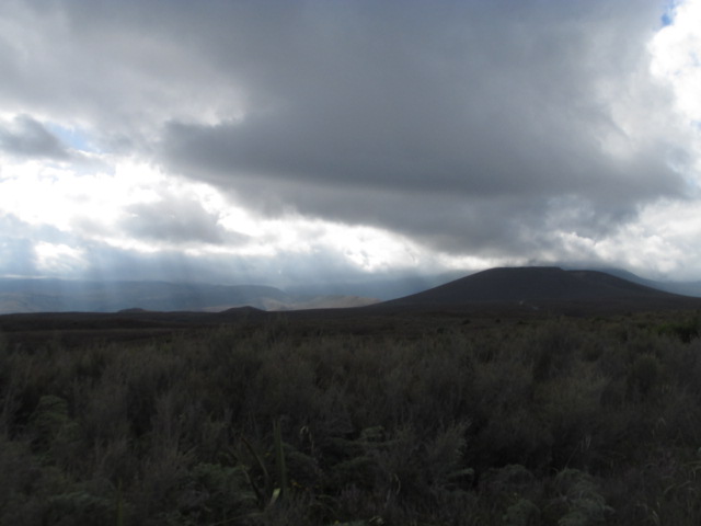
As we set off across the plains of the Taupo Volcanic Zone this morning, we bore witness to the incredible natural landscapes unique to New Zealand. Lit under ethereal rays of sunlight shining through the morning overcast, we got our first good glimpse of the three volcanoes at Tongariro National Park: Ruapehu (pronounced Roo-ah-pay-hoo), Ngauruhoe (Nowr-a-ho-ee), and of course, Tongariro itself.


Our planned 20-km hike across the Tongariro Alpine Crossing had to be cut short because of increased volcanic activity at one of the vents of Tongariro. Driving in, we were able to see a large amount of steam pouring out of this vent - quite a dramatic sight!


We stopped at the nearest village to the trails of Tongariro itself; the village of Whakapapa ("pronounced FA-KA-PA-PA", as Grant helpfully explained). The one issue we had was making lunch. As we had to take a shuttle bus to the beginning of the trail, we had roughly 15 minutes to make 24 sandwiches. So we divided and conquered and literally ran into the shuttle bus with seconds to spare. That was probably the least of our challenges for the day!

When we arrived at the entrance to the trail, we spend the first few moments being astonished at the size of the volcano and its associated lava flow. Once we tore our eyes away from the sight, the fourth year students provided the entire group with a short explanation of the tectonics responsible for the volcanoes, and of its geologic past. Once the discussion had ended, we set out.

Shilika, Roma, and Daniel explain our geographic context and the associated plate tectonics leading to the marvels behind us

Group shot! Before the exhausting journey.
Wow. That is really the only way to describe the next five hours of our lives. The Alpine Crossing trail itself was largely uphill and began at 1100 meters. We saw amazing geologic evidence of past lava flows on Ngauruhoe, and walked amongst the silent giants of the crossing for several kilometers.

Columnar basalt in an old magma chamber next to Ngauruhoe
Hiking in the valley leading to the first steep climb
Ngauruhoe, or: Mount Doom!
Once we cleared the most difficult part of the trail, the group split into two. One group climbed the rest of the treacherous slope to the rim of Ngauruhoe, while the other half observed the Emerald Lakes and Red Crater on Tongariro.

The group climbing Ngauruhoe had a very difficult task ahead of them for the final 400 meters or so - there was no clearly marked path and much of available surface was coated in very loose tephra and sediment. Each step let off a small avalanche of rocks, so we had to be careful to space ourselves so as to not injure each other. After an excruciating journey up above even the (lowest) clouds, we strained the final few meters to reach the crater rim, where an astonishing view of both the complex geologic nature of the stratovolcano and the majestic beauty of the rest of the North Island was at once visible to us.

A view into the volcano's crater: the layered structure of a stratovolcano is visible on the left
"We look like a Russian exploration team"
Looking out over Tongariro from Ngaurahoe: a floodplain is visible to the bottom left, and Blue Lake is in the centre
Fumarole (steaming vent) in the hill behind Maddy!
Meanwhile, the Emerald Lakes group got a good view of the old craters of Tongariro. Red Crater itself, at the highest point of the Alpine Crossing (~1800 m) is a currently inactive volcanic crater which was explored and sketched by the group. The bright green Emerald Lakes were a spectacular visualization of the high concentration of dissolved minerals unique in volcanic environments.

Red Crater


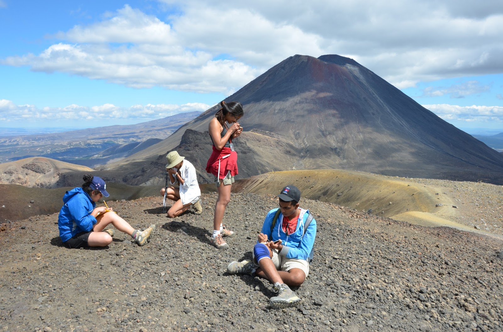
Describing landscapes, analysing samples, and taking notes with Ngaurahoe in the background
Overall, the day was exhausting. Once returning to the campsite, there was a short period of swimming before dinner, after which most people collapsed into their tents. It was truly a spectacular, once-in-a-lifetime experience for all students, and we are all extremely pleased with what we learned and accomplished.

Tomorrow we're leaving the lake (unfortunately!) and heading back to the Auckland area, where we will spend the next day observing the geology of the region. The day after that we're hopping on a plane to Christchurch!

Thanks for reading!

Day 1: Hot Pools, Geothermal Thermal Springs and New Campsite

So today we awoke to a beautiful foggy morning at the Waikite Thermal Pools. After a groggy start, we started the day with a refreshing dip in the thermal pools.


As we watched the sun rise over the fog of the boiling river, we discussed the plan for the day.


We also took a quick trip to see the source springs again (this time in proper sunlight):


Much to our dismay, we had to leave the hot pools soon after, moving on to bigger and better geologic wonders. Once we had our campsite packed up (including our soggy, dew-covered tents, which did NOT dry after an hour, as we had hoped) we made our way to the Wai-O-Tapu Geothermal Wonderland. It took a few hours, during which many people fell asleep.

The first thing we did when we arrived was visit the Lady Knox Geyser. This is a regularly erupting geyser that normally has a cycle of about 36 hours between eruptions. However, for us fine folks up early in the morning, one of the park staff enticed the geyser at a predetermined time by pouring a biodegradable surfactant (or soap, in the olden days) down the geyser's mouth. This destabilized the equilibrium between the cold layer near the surface and the superheated water below, causing a jet of water to shoot up almost 10 m in height - after the staff member had moved away, of course.


After the geyser we remained at the site and the second years learned how to take proper field notes from the fourth years. The second years were given examples of field notebooks, and allowed to sketch the geyser with the proper methods that had just been learned. We also learned about the back-arc extensional rift zone (the area of mantle convection above a subducting plate) that allowed this geothermal system to exist in the first place.


After the sketching we moved into the park itself. This was where the real wonder began.

The vast number and quality of the thermal formations was astounding. We saw several geothermal craters, bubbling mud pits and even a lime green lake of sulfur.


The most iconic feature was the Champagne Pool, a 60-meter-wide by 62-meter-deep pool of acidic, 74-degree water, adjacent to which was the "Artist's Pallette", an overflow reservoir containing bright splotches of sulfur, antimony, mercury, and ferrous salts.

A view from the edge of the Champagne Pool, looking over to the Artist's Palette

Alternate view of the Artist's Palette


Once we completed the hike, we arrived at our new campsite. The best part of the site is that it is on Lake Taupo, with a picturesque view of the Tongariro-area volcanic formations. After going for a quick dip, and a great deal of waiting to cook dinner, we were finally fed and sent off to bed.

That was our day in a nutshell. Tomorrow, TONGARIRO NATIONAL PARK awaits! (20 km hike next to volcanoes!) We hope the weather stays beautiful!

Sunday, 17 February 2013

Day 0: Arrival in Auckland

Whether it was the pilot, the food, or the tap water in Dubai, our second flight was not as pleasant as the first. Quite a few people ended up nauseated, and there was a general haze of confusion as our bodies were wrenched by the time zone acrobatics. We stopped in Melbourne to refuel, and inexplicably had to pass through customs and have our bags checked for illegally imported goods - even though we weren't spending more than 30 minutes on the other side of the gate. The hot, stagnant air of the queues certainly did nothing to help those who were already ill, and by the time we got through there were just minutes remaining on the last call for boarding. (Who designed this system, exactly?)


Though many swore off air travel after our final flight (unfortunately for them, we'll be back in the air all too soon), after it we had finally arrived in New Zealand. Approaching the runway, the isolated island's stunning and ethereal landscape came into view. This time the customs process was rather painless, although very scrutinizing - there were a few tents that had to be checked through separately, and even our shoes were examined for signs of foreign species or material that might be introduced. Protecting biodiversity is a serious issue in New Zealand!

We met up with Grant and separated into groups for the three vans. Once our stuff was packed, we set off - on the left side of the road (a curious sensation to get used to, apparently even for Grant!)


The landscape revealed the full glory that could not be appreciated from the air, as we began the winding journey south out of Auckland. Immediately visible on the horizon were the Bombay Hills, a series of volcanic cones separating Auckland from the rest of the North Island.


We stopped for a rest and a chance to take our first photos of the landscape from terra firma. Snack food was also an important part here:


A few hours of driving later, we had arrived at our first overnight stop - Waikite Valley Thermal Pools!


We got a quick look at some of the source springs, and a few people had a chance to take a dip in the naturally heated water (more on that later!), but for the most part we just hurried to set up our tents and make some dinner. (Sandwiches... mmm...)


After our exhausting, 3-day journey, we were finally here - land of ancient creatures, complex tectonics, and of course, hobbits.